Project Maps
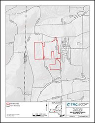
Project Area:
The Project Area, outlined in red, is comprised of the locations being evaluated for placement of project facilities.
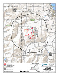
Study Area:
The Study Area, outlined in black, depicts all areas within at least two miles of the planned location of the project’s generating facility components, interconnections and related facilities.
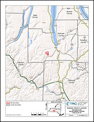
Regional Location:
The regional location map depicts the general region in which the project will be constructed.